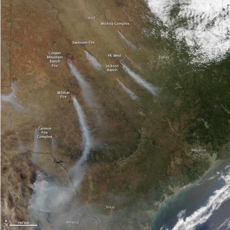
Texas wildfires smoke plumes
Image source:http://summitcountyvoice.com/2011/04/22/texas-wildfires-weather-brings-some-relief/
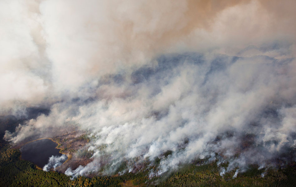
Fires in the BWCA in MN
http://minnesota.publicradio.org/display/web/2011/09/13/aerial-photos-of-the-fire-in-bwca/#.TnEu3_YVhGg.twitter
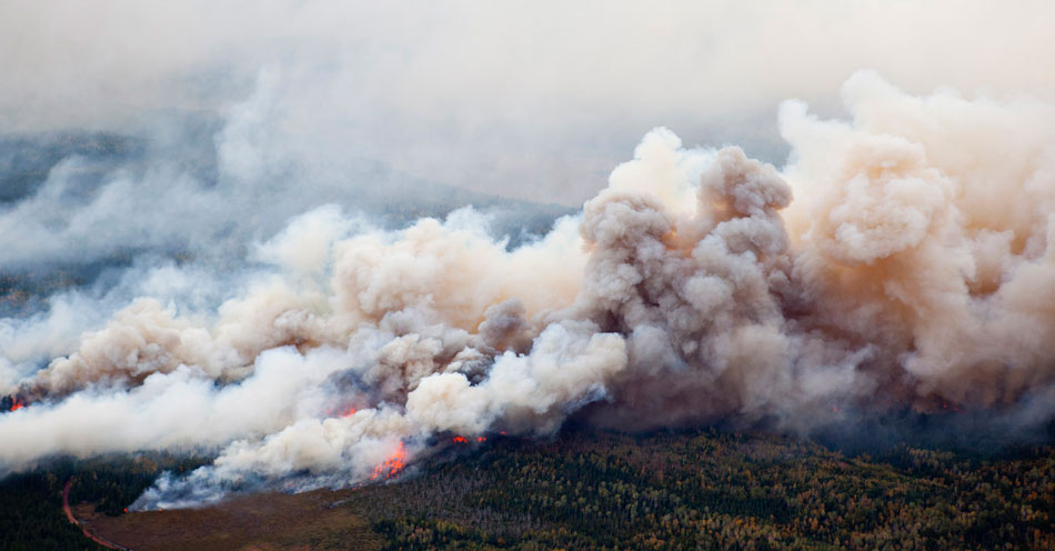
Another aerial image of the BWCA on fire
http://minnesota.publicradio.org/display/web/2011/09/13/aerial-photos-of-the-fire-in-bwca/#.TnEu3_YVhGg.twitter

Intense lightning shot
http://brainjabber.wikispaces.com/Katelin+Lee
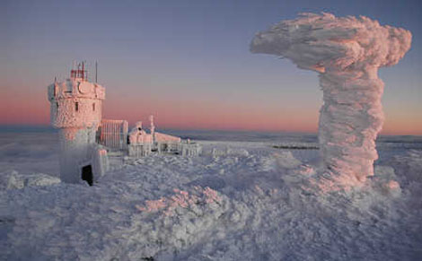
Mt. Washington (worst weather in the world) in wintertime
http://www.adventure-journal.com/wp-content/uploads/2010/01/mtwashington_470.jpg

Cleveland volcano erupting in the Aleutian Islands, AK
http://www.nasa.gov/multimedia/imagegallery/image_feature_756.html
.")
Typhoon Roka in the Pacific Ocean nearing Japan.
http://www.nasa.gov/mission_pages/hurricanes/archives/2011/h2011_Roke.html

Map of United States showing the extent of ashfall from a Yellowstone supervolcanic eruption.
http://www.theblaze.com/wp-content/uploads/2011/01/Caldera-Ashfall.jpg

Earthquake hazard map of the US
http://www.gis.com/sites/default/files/images/earthquake_map_lg.jpg
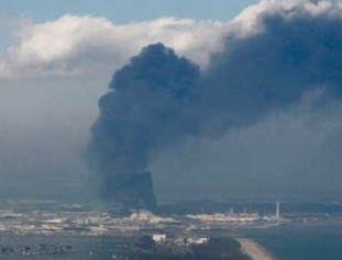
Fukushima power plant explosion after tsunami
http://www.marketoracle.co.uk/images/2011/Mar/Fukushima-Nuclear-Power-Plant-Explosion.jpg
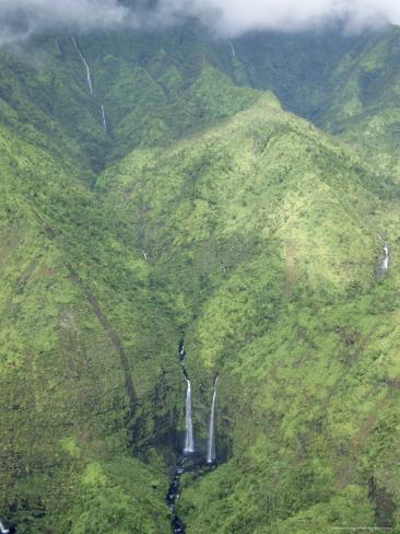
Wettest place on the planet: Mt. Waialeale on the Hawaiian island of Kauai
image source: http://www.allposters.com/-sp/The-Wettest-Place-on-Earth-Mt-Waialeale-Kauai-Hawaii-USA-Posters_i2936134_.htm
****Below is a map I created in ArcMap of the Pacific Ring of Fire boundary****

 |
| The map above shows the mass wastage prone areas of the east coast of the United States |
 |
This map shows the high landslide risk areas of the United States such as the Appalachian mountain region of the East Coast, the Pacific west coast, and the front range of the Rocky Mountains. |

High resolution image from NASA on the large Nor'Easter that hit the northeast this weekend
Source: http://www.weather.com/outlook/weather-news/news/articles/northeast-snow-from-space_2011-10-31

Hazard prone parcels in Forest Falls, CA map.
